 |
Parks and National Parks around Khao Lak, Phang Nga
Destination: PhangNga
Park >>
Similan Island National Park (อุทยานแห่งชาติหมู่เกาะสิมิลัน) (PhangNga) 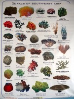 "Similan" is a Yawi or Malay word which means nine or a group of nine islands. Similan Island National Park covers 32,000 acres. It was declared a national park on 1st September 1982. "Similan" is a Yawi or Malay word which means nine or a group of nine islands. Similan Island National Park covers 32,000 acres. It was declared a national park on 1st September 1982.The Similan islands are highly praised for their beautiful scenery, both onshore and underwater. The best time to visit is between November and April. The Similan Islands are a group of nine islands, named as follows from south to north. Huyong island known as Similan Island No. 1, Payang Island known as Similan Island No. 2, Payan Island known as Similan Island No. 3, Miang Island known as Similan Island No. 4 (The headquarters office is located on Miang Island), Ha Island known as Similan Island No. 5, Payu Island known as Similan Island No. 6, Pousar Rock known as Similan Island No. 7, and Similan Island or Similan Island No. 8. Bangu Island known as Similan Island No. 9 is the northernmost of the islands. Visitors may contact the park office at Thap Lamu. For further information call Tel.: 076-595045. There are bungalows, tents and also restaurants available. 93 Moo 5 Kam Kaen, Thai Mueang, Phang Nga 82120 Island >>
Surin Islands National Park (อุทยานแห่งชาติหมู่เกาะสุรินทร์ ) (KhuraBuri)  Surin Island National Park is an archipelago of 5 islands: Koh Surin Nua, Koh Surin Tai, Koh Ri, Koh Khai, and Koh Klang. The National Park covers an area of 84,375 rai (33,750 acres). Surin Island National Park is an archipelago of 5 islands: Koh Surin Nua, Koh Surin Tai, Koh Ri, Koh Khai, and Koh Klang. The National Park covers an area of 84,375 rai (33,750 acres).Koh Surin was declared a national park on July 9, 1981. The archipelago is located in the Andaman Sea, near the Thai-Burmese sea border, on the west coast of Thailand. There are beautiful and unspoiled coral reefs; the area is suitable for snorkeling. The best time to visit is from November to April. Surin Island National Park belongs to Tambon Koh Phra Thong. Khura Buri, Phang Nga 82150 Park >>
Phang Nga Bay National Park (อุทยานแห่งชาติอ่าวพังงา) (PhangNga) 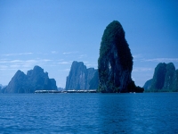 Phang Nga Bay National Park covers a vast area of about 250,000 rai (100,000 acres) both onshore and offshore, including parts of Amphoe Muang, Amphoe Takua Thung, and Amphoe Koh Yao. Phang Nga Bay National Park covers a vast area of about 250,000 rai (100,000 acres) both onshore and offshore, including parts of Amphoe Muang, Amphoe Takua Thung, and Amphoe Koh Yao.It was declared a national park on 29th April B.E. 2524 (1981). Phang Nga Bay National Park is the second seacoast national park after Tarutao National Park. It has striking scenic views because of a mass of limestone formations scattered around in the sea near the shore. Also, as a result of natural changes, caves and rock formations have been formed. The park is also fertile with mangroves. The best time to visit is between December and April and the most popular way to see around the National Park is to take a boat ride through the area. Phang Nga Bay National Park is situated 12 km from Phang Nga Town. 80 Moo 1 Koh Panyi, Phang Nga 82000 Park >>
Khao Na Yak National Park (Khao Na Yak National Park) (KhaoLak) 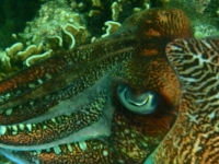 Khao Na Yak National Park is a completely undeveloped national park in front of Thap Lamu. The narrow peninsula of Khao Na Yak is the northern extension of the wellknown Thai Mueang - Lam Pi National Park. The peninsula is covered by dense forest which is inhabited by many birds and monkeys sometimes frolicking at the beach. Offshore of the northern tip towards Khao Lak the sea floor is covered by many coral which grew again in profusion after the Tsunami of 2004. Many fish seek shelter among the corals. A large population of 4 species of moray eels can be seen sticking their heads out of their holes among the corals. It is not uncommon to see more than a dozen of them during one snorkel trip. A good guide can show you also a family of sepia playing just two meters below the surface. Khao Na Yak National Park is a completely undeveloped national park in front of Thap Lamu. The narrow peninsula of Khao Na Yak is the northern extension of the wellknown Thai Mueang - Lam Pi National Park. The peninsula is covered by dense forest which is inhabited by many birds and monkeys sometimes frolicking at the beach. Offshore of the northern tip towards Khao Lak the sea floor is covered by many coral which grew again in profusion after the Tsunami of 2004. Many fish seek shelter among the corals. A large population of 4 species of moray eels can be seen sticking their heads out of their holes among the corals. It is not uncommon to see more than a dozen of them during one snorkel trip. A good guide can show you also a family of sepia playing just two meters below the surface.Khao Na Yak has also some of the most beautiful small beaches in the Khao Lak region, named Paradise Beach or Robinson Beach by the snorkel guides. Only a few boatmen know how to access these idyllic beaches due to the rocks in front. Another beach is covered with thousands of hermit crabs walking over the sand. Thai Mueang, Phang Nga
Park >>
Si Phang Nga National Park (อุทยานแห่งชาติศรีพังงา) (PhangNga) 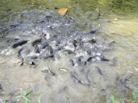 Sri Phang Nga National Park is a very beautiful Park, which covers Amphoe Khura Buri and Amphoe Takua Pa and is situated 100 kilometers from Phang Nga town. The park was established in honor of His Majesty the King on his 60th birthday. Sri Phang Nga National Park is a very beautiful Park, which covers Amphoe Khura Buri and Amphoe Takua Pa and is situated 100 kilometers from Phang Nga town. The park was established in honor of His Majesty the King on his 60th birthday.This forested piece of land is home to a large variety of flora and fauna. Admission is 100 Baht. Visitors wishing to stay overnight in the park should bring their own tents. Contact the Sri Phang Nga National Park at Tel: 076-412611. 65/16 Moo 2 Bang Wan, Khuraburi, Phang Nga 82150 Park >>
Khao Lak - Lamru National Park (อุทยานแห่งชาติเขาหลัก-ลำรู่) (PhangNga) 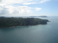 Khao Lak - Lamru National Park covers a total area of 125 sq km along the western shoreline. It includes parts of Kapong, Thai Mueang and Takua Pa. Khao Lak - Lamru National Park covers a total area of 125 sq km along the western shoreline. It includes parts of Kapong, Thai Mueang and Takua Pa.Khao Lak - Lamru National Park is a combination of seashore and mountains covered by pristine jungle. The highest point in the park is 1,077 m above sea level. The mountains of Khao Lak - Lamru Park provide the source for the Phang Nga and Takua Pa rivers. The park has been split up into various zones. The two main areas are traversed by the Phang Nga - Takua Pa Road H4090. In the National Park you can enjoy a variety of activities such as trekking, camping, swimming, rafting, bird watching, etc. Besides some nice waterfalls the park has also excellent beaches including ‘Hat Lek’ which is a very pretty beach. The area to the west, known also as Khao Na Yak National Park, is excellent for snorkeling to easily see 4 kinds of moray eel, dozens of fire fish, several sepia cuttlefish and all sorts of small and large fish in the coral stock that has recovered very well from the tsunami in 2004 and the coral bleaching in 2010. Khuek khak, Takua Pa, Phang Nga 82190 Khao Lampi - Hat Thai Mueang National Park (อุทยานแห่งชาติเขาลำปี-หาดท้ายเหมือง -Aew) (PhangNga) 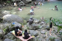 Khao Lam Pi - Hat Thai Mueang National Park occupies an area of 45,000 rai (18,000 acres). It was declared a national park on April 14, 1988. The park offers beautiful nature scenery with the most popular sites being the Tone Prai and Lam Pi Waterfalls which flow from the 622 meter high Kha Nim mountain. It is a sanctuary for an abundance of birds and animals including hawks, eagles, pheasants, red barn owls, and pig-tailed monkeys. Khao Lam Pi - Hat Thai Mueang National Park occupies an area of 45,000 rai (18,000 acres). It was declared a national park on April 14, 1988. The park offers beautiful nature scenery with the most popular sites being the Tone Prai and Lam Pi Waterfalls which flow from the 622 meter high Kha Nim mountain. It is a sanctuary for an abundance of birds and animals including hawks, eagles, pheasants, red barn owls, and pig-tailed monkeys.The second part of the sanctuary is Hat Thai Mueang. It is a beautiful coastline of beaches 40 meters wide and 14 km in length. Sea Turtles come ashore here to lay and bury their eggs; it is also a sanctuary for many nesting birds. For more information call Tel.: 084-0597879, 076-417206 Khao Lam Pi-Hat Thai Mueang National Park is located at Moo 6, Tambon Thai Mueang, on H4 between KM32 and 33. Thai Mueang, Phang Nga 82120 Park >>
Sa Nang Manora Forest Park (วนอุทยานสระนางมโนห์รา) (PhangNga) 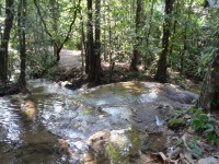 Sa Nang Manora Forest Park covers a total area of 180 rai. It has a topography of limestone mountains running northeast to southwest and covered with rain forest. Sa Nang Manora Forest Park covers a total area of 180 rai. It has a topography of limestone mountains running northeast to southwest and covered with rain forest. There is an Oyster Shell Cave about 1,300 meters from the forestry park office. Inside the cave is an oyster grave yard. The Bat Dung Cave is about 2,300 meters from the park office. This cave is bigger than the Oyster Shell Cave and many bats live here. The paths to these caves are not too steep so it is easy to walk to them. Kaeo is a large cave which is 3 km from the park office and 1,500 meters from the Bat Dung Cave. Inside are beautiful glittering stalagmite and stalactite formations. Sa Nang Manora Forest Park is situated inside the Khao Thoi Nang Hong National Forest Reserve area in Tambon Nop Pring. Moo 3 Nop Pring, Phang Nga 82000
Park >>
Laem Son National Park (Laem Son National Park) (Ranong) 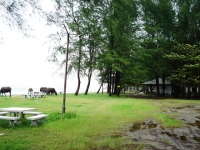 Laem Son National Park is situated on the Andaman Sea coast in Ranong Province. Laem Son National Park was declared a national park in August 1983. It consists of approximately 60 km of coastline and 15 islands. The park covers a total area of 315 sq.km, of this area 85% is open water. The park is the 12th Marine National Park of Thailand and is its 6th largest. Laem Son National Park is situated on the Andaman Sea coast in Ranong Province. Laem Son National Park was declared a national park in August 1983. It consists of approximately 60 km of coastline and 15 islands. The park covers a total area of 315 sq.km, of this area 85% is open water. The park is the 12th Marine National Park of Thailand and is its 6th largest.The national park has two climates: rainy season with heavy rainfalls during May - November and summer during December - April. On the coast Laem Son National Park consists of three parts: Bang Baen Beach in Kapoe District, Praphat Beach in Suksamran District and Ao Khoei in Khuraburi District of Phang Nga Province. Laem Son National Park has also a lot of islands with beautiful underworld surroundings. Especially 2 islands, Koh Kam Yai and Koh Kam Nui, also including 8 different islands which are Koh Moo, Koh Piak Nam Noi, Koh Piak Nam Yai, Koh Tao, Koh Khang Khao and Koh Lan. Accommodation and restaurants are available at Bang Baen Beach in Laem Son National Park. For more information contact Tel.: 077-861431, 077-861432. Suggestion; Time to go: Summer begins from mid February until mid May. South east wind blows in to cover the area and make it usually hot. It will be hottest in April with the highest average temperature of 35 degree Celsius. However, it is not too hot as it is the peninsula close to the sea. Sea wind and steam will make it a bit cooler. Therefore, it is most suitable to visit Laem Son National Park in summer. Park >>
Ngao Waterfall National Park (Ngao Waterfall) (Ranong) 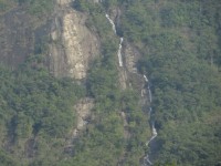 Ngao Waterfall National Park covers a total area of 417,500 Rai or 668 square kilometers approximately. It was declared a national park in June 1999. Ngao Waterfall National Park covers a total area of 417,500 Rai or 668 square kilometers approximately. It was declared a national park in June 1999.Ngao Waterfall is a large waterfall cascading down from a high mountain and is visible from the rest area near the waterfall. A new species of freshwater crab endemic to Thailand, the "Phu Chao Fah", can only be found in the Ngao Waterfall area. For further information, please call: 077-848181 Ngao Waterfall is located in KM 626 of H4, and 12 km from Ranong Town. Ban Ngao, Ranong
Park >>
Khao Sok National Park (อุทยานแห่งชาติเขาสก) (SuratThani) 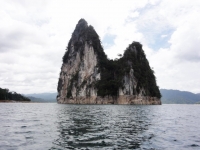 Khao Sok Nation Park is one of the most beautiful national parks in Thailand because of Its majestic scenery and biological diversity.The park is named by local "Gui – Lin of Thailand", which refers to a very beautiful place in China. The Royal Forest Department declared Khao Sok as the 22nd national park of Thailand on December 22nd, 1980. Khao Sok Nation Park is one of the most beautiful national parks in Thailand because of Its majestic scenery and biological diversity.The park is named by local "Gui – Lin of Thailand", which refers to a very beautiful place in China. The Royal Forest Department declared Khao Sok as the 22nd national park of Thailand on December 22nd, 1980. The Bua Phut The biggest flower in Thailand with a diameter in the neighborhood of 50-90 cm. This parasitic plant sucks water from the roots and the trunk of a climber called Yarnkaitom. Only the flower of Bua Phut, sticks out from the ground in the rainy season or other times when the soil is highly humid. It takes 9 months to grow from the size of a small button to a larger one, only to bloom for no longer than 7 days a year. Bua Phut flowers can be seen throughout the year but they bloom mostly from November to April. Moo 6 Khlong Sok, Phanom, Surat Thani 84250 Rajjaprabha Dam (Chiew Lan Lake) (เขื่อนรัชชประภา) (SuratThani) 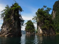 The huge Chiew Lan Lake is formed by Rajjaprabha Dam. The dam was built in 1982, it is 94 meters high and 761 meters in length. Most of Chiew Lan Lake is part of Khao Sok National Park. At the far end some river valleys belong to Klong Saeng Wildlife Reserve. The huge Chiew Lan Lake is formed by Rajjaprabha Dam. The dam was built in 1982, it is 94 meters high and 761 meters in length. Most of Chiew Lan Lake is part of Khao Sok National Park. At the far end some river valleys belong to Klong Saeng Wildlife Reserve.The reservoir covers an area of 185 square kilometers. The lake offers an incomparably breathtaking view of limestone mountains and over 200 small islands. Rajjaprabha Dam is about 70 km west from Surat Thani. 53 Moo 3, Khao Phang, Ban Ta Khun, Surat Thani 84230 Park >>
Klong Phanom National Park (อุทยานแห่งชาติคลองพนม) (SuratThani) Rates: 20 to 100 Baht 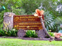 Klong Phanom National Park situated at 107 Moo 4, Klong Sok Sub-district, Phanom, Surat Thani 84250 Klong Phanom National Park situated at 107 Moo 4, Klong Sok Sub-district, Phanom, Surat Thani 84250 107 Moo 14, Khlong Sok, Phanom, Surat Thani 84250
Park >>
Than Boke Khorani National Park (อุทยานแห่งชาติธารโบกธรณี) (Krabi) Rates: 10 to 50 Baht 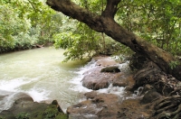 Than Boke Khorani National Park covers an area of 37.5 rai. The Park is covered by a diverse canopy of various species of tree, such as wild gardenia, Asoka, and Apocynaceae that are scattered around Sa Boke Khorani. Than Boke Khorani National Park covers an area of 37.5 rai. The Park is covered by a diverse canopy of various species of tree, such as wild gardenia, Asoka, and Apocynaceae that are scattered around Sa Boke Khorani.At the north end of Sa Boke Korani, which flows through a winding passage in the mountain, is a wood carving of Lord Buddha's footprint and a shrine of Chao Pho To Yuan - To Chong. Other attractions in the park include several limestone mountain caves, verdant mangrove forests and beautiful islands which can be reached only by boat. Admission fee for adults and children are 200 and 100 baht per person. The Park does not provide accommodation, but camping in the park is allowed although tourists have to bring their own tents. For more information, Tel. 075-681071, 075-682058. 2/2 Moo 2, Ao Luk - Laem Sak Rd., Ao Luk Tai, Ao Luk, Krabi 81110 Hat Nopparat Thara - Mu Koh Phi Phi National Park (Hat Nopparat Thara - Mu Koh Phi Phi National Park ) (Krabi) Hat Nopparat Thara - Mu Koh Phi Phi National Park comprises 388 sq. km. of land and sea Park in Amphoe Mueng of Krabi Province in the west coast of the Andaman Sea. The land portion of this Park comprises 65 square kilometers. One of the most interesting in the park is the Shell Fossil, aged by archeologists at being over 75 million years old. Hat Nopparat Thara - Mu Koh Phi Phi National Park is situated about 17 km from Krabi town.
Park >>
Sirinath Marine National Park (วนอุทยาน สิรินาถ) (Phuket) 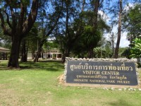 Sirinath National Park, was called Nai Yang Beach and declared in 1981. It was the first National Park in Phuket and the 31st National Park of Thailand. In 1992, it was changed in commemoration of the 60th birthday of Her Majesty Queen Sirikit. Sirinath National Park, was called Nai Yang Beach and declared in 1981. It was the first National Park in Phuket and the 31st National Park of Thailand. In 1992, it was changed in commemoration of the 60th birthday of Her Majesty Queen Sirikit. The park is dedicated to the conservation of sea turtles which visit the beach annually to nest but also serves to protect the coral and sea life which lies directly off the coast of Nai Yang Beach. The protected zone covers the entire stretch of Nai Yang Beach, reaching from the northern end of Nai Thon Beach all the way past Sarasin bridge and a little onwards around the top of the island. The northern end is not good for swimming because of the changing currents and strong riptide. Admission 200B This park runs from the western Phang-Nga border south to the headland that separates Nai Yang from Nai Thon. 89/1 Moo 1, Baan Nai Yang, T. Saku, Thalang, 83140 Phuket Tel.: 076-328226 Park >>
Khao Phra Taeo Wildlife Park (Khao Phra Taeo Wildlife Park) (Phuket) Khao Phra Taeo Wildlife Park is a center for study of the environment and the forest vegetation is spectacular. Khao Phra Taeo Wildlife Park is located near Amphoe Thalang, 22 km from Phuket Town.
|
New to t-Globe?
Register for free to get the full power of this web site!
Registered members will be able to: |
|||||||||||||||||||||||||||||||||||||||||||||||||||||||||||||||||||||||||||||||||||||||||||||||
|
|

